Showing posts with label Transport for London. Show all posts

Canning Town (CNT/ZCB)

An updated version of this station profile can now be found on our dedicated railway station website

Canning Town is a major interchange of the Jubilee Line (between North Greenwich and West Ham) and two Docklands Light Railway lines (between East India and Star Lane and Royal Victoria and West Silvertown) and local buses in East London.
A Docklands Light Railway train arrives


Information
Type: Transport for London (Jubilee Line &
Docklands Light Railway)
Station code: CNT/ZCB
Opened: 1847
Platforms: 6

The station was first opened in 1847 as Barking Road by the Eastern Counties & Thames Junction Railway.

The station was renamed Canning Town in 1873 and moved in 1888, with another move to the current site (the site of the former Thames Iron Works [1]) in 1995 as part of the new Docklands Light Railway (DLR) line to Beckton. The biggest change came with the arrival of the Jubilee Line in 1999, the Jubilee Line Extension emerges into the daylight just before the station. In 2005 more platforms for the DLR's line to London City Airport were added.

Canning Town is a triple decker building with the booking hall below ground and the Jubilee Line platforms above it, the Beckton DLR platforms are on the top level [2][3]. The latest DLR platforms are on ground level next to the Jubilee Line - though passengers need to go down to the booking hall before they can come back up for interchange.
Jubilee Line 96024 prepares to depart

The Jubilee Line platform

The lower level DLR platforms

View down the Jubilee Line platform

Jubilee Line 96015 arrives


[1] Jason Cross, London Underground Guide 2017 (Train Crazy, 2017) p. 108
[2] Paul Moss, London Underground (Haynes, 2014) p. 166
[3] Mike Horne, The Jubilee Line (Capital Transport, 2000) p. 73

Ealing Common (ZEC)

An updated version of this station profile can now be found on our dedicated railway station website

Ealing Common is a stop on the London Underground in West London. It is between Ealing Broadway or North Ealing and Acton Town on the District and Piccadilly Lines.
A Piccadilly Line train arrives

Information
Type: Transport for London (District & Piccadilly Lines)
Station code: ZEC
Opened: 1879
Platforms: 2

Ealing Common was opened by the District Railway in 1879 on it's extension from Turnham Green to Ealing Broadway. The station was renamed Ealing Common & West Acton in 1886. It kept this name until 1910 when it reverted back to the original one [1]. Electric trains began operating at Ealing Common in 1905.

The Piccadilly Line reached Ealing Common in 1932 after it was extended from Hammersmith [2]. The Piccadilly Line took over the District Line branch to South Harrow (now the Uxbridge branch). The station was rebuilt in 1930-31 with a new Charles Holden building replacing the original 1879 structure. To the East of the station is the District Line's Ealing Common depot.
Steps up to the ticket hall

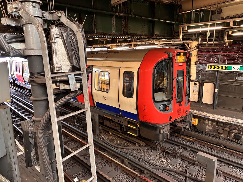
A District Line S7 train waits

View down the platforms, both have concrete canopies

A District Line S7 train departs

[1] Jason Cross, London Underground Guide 2017 (Train Crazy, 2017) p. 114
[2] Desmond F. Croome, The Piccadilly Line (Capital Transport, 1998) p. 28

Stratford (SRA)

An updated version of this station profile can now be found on our dedicated railway station website

Stratford is a major transport hub in East London, an interchange of the Great Eastern Main Line out of London Liverpool Street, London Overground, two London Underground lines and the Docklands Light Railway. It is also next to a bus station!
Information
Type: National Rail
(Great Eastern Main Line) &
Transport for London
(Central & Jubilee Lines,
Docklands Light Railway,
London Overground)
Station code: SRA
Opened: 1839
Platforms: 19

Stratford was opened by the Eastern Counties Railway in 1839 [1]. The Northern & Eastern Railway also reached Stratford the following year. The London, Tilbury & Southend Railway reached Stratford in 1854. By then Stratford was already becoming a very busy station with concerns about congestion. Stratford became part of the Great Eastern Railway and later the LNER with electrification completed through the station early after the Second World War. Because of the nature of how the station has developed it has high and low-levels [2].

The London Underground reached Stratford in 1946 with an extension of the Central Line from Liverpool Street. The Central Line is in tunnels either side of Stratford but climbs to the open air in the station. This makes Stratford one of only two stations on the Underground where passengers have to go up an escalator to reach their tube train!

The Docklands Light Railway was next to arrive, Stratford being one of the original stations on the DLR opening in 1987 [3]. One interesting thing to note is that the DLR line near Stratford used an existing railway bridge next to the Great Eastern Main Line as it ran over a former British Rail line [4]. It was the clearance available with the girders on the bridge that dictated the dimensions and final design of the top contact third rail used by the DLR [5].

The low-level part of Stratford station was rebuilt for the arrival of the Jubilee Line in 1999 [6]. Stratford is the Eastern terminus of the line. The next line to reach Stratford will be the Elizabeth Line (Crossrail) when it finally opens.

As well as the Transport for London services Stratford is served by Greater Anglia on services East including to Southend Victoria, Norwich and Clacton-on-Sea. It is also served by some c2c services to Shoeburyness.
Jubilee 96075 and friend at Stratford

Greater Anglia 321 359 at Stratford

View of the busy Stratford layout with Westfield in the left background

A Central Line train

TfLRail 315 843 arrives

London Overground 378 207 prepares to head off

[1] Jason Cross, London Underground Guide 2017 (Train Crazy. 2017) p. 158
[2] J.E. Connor, Branch lines around North Greenwich (Middleton Press, 2001) Fig. 14
[3] Robert Griffiths, The Central Line (Past and Present, 2007) p. 31
[4] Stephen Jolly & Bob Bayman, Docklands Light Railway (Capital Transport, 1986) p. 26
[5] David Hartland, Brecknell Willis & Co. Collectors for Trains, Trams and Trolleys (Middleton Press, 2004) p. 60
[6] Mike Horne, The Jubilee Line (Capital Transport, 2000) p. 79

Covent Garden (ZCV)

An updated version of this station profile can now be found on our dedicated railway station website

Covent Garden is a Piccadilly Line station in central London between Leicester Square (just 250 metres or 0.16 miles away) and Holborn in the always busy West End.
Information
Type: Transport for London
(Piccadilly Line)
Station code: ZCV
Opened: 1906
Platforms: 2

The station was opened by the Great Northern, Piccadilly & Brompton Railway in 1907 (a few months after the rest of the line opened) [1] with a standard ground level Leslie Green designed station building.

Unlike most stations in the central section of the London Underground Covent Garden does not have escalators. The platforms are reached via lifts or stairs (for the fit/foolhardy - there are 193 steps![2]) Because of this the station is often overcrowded and on Saturday afternoons becomes exit only.

Interestingly the short journey from Leicester Square to Covent Garden with a Zone 1 fare (at time of writing £4.90) works out at over £30 per mile, one of the most expensive railway journeys in the country!
A Piccadilly Line 73ts train waits to depart

Former signal cabin from Covent Garden, the proximity of Leicester Square is evident (yellow boxes left centre)

Surface building

Platform view

The station name is displayed on the tile wall of the platform

[1] Desmond F. Croome, The Piccadilly Line (Capital Transport, 1998) p. 11
[2] Jason Cross, London Underground Guide 2017 (Train Crazy, 2017) p. 113

Embankment (ZEK)

An updated version of this station profile can now be found on our dedicated railway station website

Embankment is a major interchange station on the London Underground on the North bank of the Thames near Trafalgar Square and inbetween London Charing Cross and London Waterloo.

Information
Type: Transport for London
(Bakerloo, Circle,
District & Northern Lines)
Station code: ZEK
Opened: 1870
Platforms: 6
The station was opened in 1870 by the District Railway as part of its extension from Westminster to Blackfriars [1]. The station was near to Charing Cross railway station and also named Charing Cross. The Baker Street & Waterloo Railway's (later Bakerloo Line) deep-level tube line reached the station in 1906. Although next to the District Railway station and with an interchange the Baker Street & Waterloo called their station Embankment (Charing Cross) [2].

The Charing Cross, Euston & Hampstead Railway (later the Northern Line) reached the station in 1914. To avoid confusion the entire station was renamed Charing Cross in 1915. The station was renamed Charing Cross Embankment in 1974 and finally to just Embankment in 1976. The Bakerloo/Northern Line station Strand/Trafalgar Square station to the North was renamed Charing Cross [3]!


Embankment is served by the Circle & DIstrict Lines on the sub-surface platforms and the Bakerloo & Northern Lines on the deep-level platforms. The station received a major refurbishment in 1988 with gloss white vitreous panelling in many areas of the station. LU commissioned the artist Robyn Denny to produce artwork to lighten up the station which resulted in the coloured streamer design [4].
An S Stock train departs on the sub-surface platforms

Northern Line 95ts 51646 arrives on a North bound service

This way to the Bakerloo Line

Sub-surface platforms

A Bakerloo Line train waits to depart

As does a District Line train

[1] Jason Cross, London Underground Guide 2017 (Train Crazy, 2017) p. 120 
[2] Mike Horne, The Bakerloo Line (Capital Transport, 2001) p. 18
[3] Chris Nix, Hidden London Charing Cross (London Transport Museum, 2017) p. 5
[4] Paul Moss, London Underground (Haynes, 2014) p. 140

Kilburn Park (ZKP)

An updated version of this station profile can now be found on our dedicated railway station website

Information
Type: Transport for London (Bakerloo Line)
Station code: ZKP
Opened: 1915
Platforms: 2
Kilburn Park is in between Queen's Park and Maida Vale. Like a number of stations on this stretch of the Bakerloo Line it was opened in 1915 as part of the line's extension from Paddington to Queen's Park [1].

After opening for 10 days Kilburn Park (originally it was to have been called just Kilburn) was the Northern terminus of the line as Queen's Park's opening was delayed meaning that passengers could only go as far as Kilburn Park and trains had to continue empty up to Queen's Park.

As with other stations on the line it was designed by Stanley Heaps to a modified Leslie Green design and the exterior of the building has glazed terracotta. The station is Grade II listed. Kilburn Park was one of the first stations designed for escalators instead of lifts.
A Bakerloo Line 72ts train arrives

Station entrance

Original signage 

Platform view

[1] Mike Horne, The Bakerloo Line (Capital Transport, 2001) p. 29

Maida Vale (ZMV)

An updated version of this station profile can now be found on our dedicated railway station website

Information
Type: Transport for London (Bakerloo Line)
Station code: ZMV
Opened: 1915
Platforms: 2
Maida Vale is one of the stations built for the Bakerloo Line's extension from Paddington to Queen's Park, the station opening in 1915.

When the station opened it was the first station (and uniquely at the time) to be staffed entirely by women [1] who were being hired to roles previously reserved by men to replace men who had gone to the war.

The station building is to the common, of the time, Leslie Green design though was designed by his assistant Stanley Heaps. Inside the ticket foyer is an interesting mosaic of the London Underground "bullseye" logo, built not long before the logo changed to the one used ever since. The station is Grade II listed.
A Bakerloo Line 72ts train stands at Maida Vale 
Station exterior, with original signage

Bullseye mosaic

Analogue time keeping between the platforms

Main entrance

[1] Paul Moss, London Underground (Haynes, 2014) p. 56

Lambeth North (ZLN)

An updated version of this station profile can now be found on our dedicated railway station website

Lambeth North is the penultimate stop Southbound on the Bakerloo Line and the line's original (but temporary) Southern terminus.

Information
Type: Transport for London
(Bakerloo Line)
Station code: ZLN
Opened: 1906
Platforms: 2
Lambeth North was opened as Kennington Road in March 1906 along with the rest of the original stretch of the Baker Street & Waterloo Railway. The Southern terminus of the line was (and still is) Elephant & Castle but this was not ready for the initial opening so Kennington Road served as the Southern terminus until August [1].

The station was renamed Westminster Bridge Road in July (while still the terminus) and didn't get the name Lambeth North until 1917 [2]. In WW2 Lambeth North was badly damaged by a nearby hit of a very large German bomb and had to have parts of the tunnel and platforms rebuilt.

Access to the platforms from the Leslie Green designed surface building and ticket office is via lifts and a spiral staircase. The station is the nearest tube station to the Imperial War Museum. Just North of the station is a crossover and an access line to the Bakerloo Line's London Road depot.
A 72ts train arrives

Look down the platform

Station signs
[1] Jason Cross, London Underground Guide 2017 (Train Crazy, 2017) p. 137
[2] Mike Horne, The Bakerloo Line (Capital Transport, 2001) p. 25

Kingsbury (ZKY)

Kingsbury is a stop on the London Underground Jubilee Line in north west London between Wembley Park and Queensbury.

Jubilee Line 96094 departs


Information
Type: Transport for London (London Underground Jubilee Line)
Station code: ZKY
Opened: 1932
Platforms: 2

The station was opened in 1932 as part of the Metropolitan Railwway's new branch to Stanmore [1]. The following year the Metropolitan Railway became part of London Transport. The station was transferred to the Bakerloo Line in 1939. Finally, in 1979 the station became one of the original stops on the new Jubilee Line.

The station building is in a parade of shops on the Kingsbury Road. The platforms are in a cutting with steps or lifts down from street level and have canopies.

Under the station building

Platform building and canopy

Arrival
Heading off


[1] Jason Cross, London Underground Guide 2017 (Train Crazy, 2017) p. 137

Edgware Road Circle, District, Hammersmith and City Lines (ZEM)

Edgware Road is the terminus of the London Underground District Line branch from Wimbledon and a stop on the Circle and Hammersmith & City Lines between Paddington and Baker Street. It is a completely different station to the Bakerloo Line station of the same name (which is about 150m away).

An S7 stock train prepares to depart


Information
Type: Transport for London (London Underground
Circle, District & Hammersmith & City Lines)
Station code: ZEM
Opened: 1863
Platforms: 4

Edgware Road is one of the oldest stations on the Underground being part of the Metropolitan Railway's original line between Paddington and Farringdon [1]. The station is built in a cutting, east to the station used to be the Metropolitan Railway's engine and carriage sheds [2] before they were moved to Neasden due to a lack of space in the early 1880s.

The station was built with a high arched roof of wrought iron and glass and was unique in being dressed with artificial stone [3]. The station is served by three sub-surface lines with thirty-six trains an hour.

Way down to the platforms

Station entrance

All trains are S7 Stock

On the platform

Down the platform


[1] Jason Cross, London Underground Guide 2017 (Train Crazy, 2017) p. 119
[2] Desmond F Croome, The Circle Line (Capital Transport, 2003) p. 13
[3] Ibid. p. 12