Credenhill

Credenhill is a now closed station in Herefordshire on the Hereford, Hay & Brecon Railway between Hereford Moorlands and Moorhampton. It served a small village and also the former RAF Credenhill (now the headquarters of the SAS!)

Information
Type: National Rail
(Hereford, Hay &
Brecon Railway)
Opened: 1863
Closed: 1962
Platforms: 1
The railway grew out of an early nineteenth century tramroad with the eventual line connecting Hereford to Three Cocks Junction where it joined the Mid-Wales Railway. Credenhill was an intermediate station on the first section that opened between Hereford and Moorhampton in 1863. The full line was opened the following year.

The line was later amalgamated into the Midland Railway and later the LMS. Although through passenger services did go through to Swansea for a time the line never became a trunk route. Later the station became part of British Railway's Western Region but remained a backwater.

Credenhill was closed in 1962 as passenger services along the line ceased. The line closing for good in 1964.
Credenhill, with Midland Railway style nameboards (KD collection)

Kilburn (ZKI)

Kilburn is a stop on the Jubilee Line between Willesden Green and West Hampstead. Metropolitan Line trains pass Kilburn but do not stop at it.

Information
Type: Transport for London
(Jubilee Line)
Station code: ZKI
Opened: 1879
Platforms: 2
The station was opened as Kilburn & Brondesbury by the Metropolitan Railway in 1879, it kept this name until 1950 when it was renamed Kilburn [1]. As with other stations on this branch of the Metropolitan Line (as it became after the creation of London Transport in 1933) the station was taken over by the Bakerloo Line in 1939.

The station was rebuilt at the same time. An island platform serving the Bakerloo Line replacing two facing platforms. In 1940 the Metropolitan Line stopped serving the station, though continue to pass on through Kilburn [2] on the two outer tracks [3]. The Chiltern Main Line also passes the station.

In 1979 the Stanmore branch, including Kilburn, of the Bakerloo became the Jubilee Line. The station received a major refurbishment in 2005.
Stratford bound 96ts 96103 arrives at the station

A Metropolitan Line train passes

Platform building

View down the platform 
Under the canopy

[1] Vic Mitchell & Keith Smith, Baker Street to Uxbridge & Stanmore (Middleton Press, 2006) Fig. 20
[2] Jason Cross, London Underground Guide 2017 (Train Crazy, 2017) p. 136
[3] Mike Horne, The Jubilee Line (Capital Transport, 2000) p. 21

Wendover (WND)

Wendover serves the Buckinghamshire town of the same name and surrounding villages, although a National Rail network station nowadays it was once part of the London Underground.

Information
Type: National Rail (London
Marylebone-Aylesbury Line)
Station code: WND
Opened: 1892
Platforms: 2
The station was opened by the Metropolitan Railway in 1892 on it's extension through to Aylesbury [1]. The station was also served by the Great Central Railway from 1899.

When the Metropolitan Railway became part of London Underground Wendover was one of the stations on the Metropolitan Line although served by steam services (steam locomotives taking over from electric locomotives at Rickmansworth [2]). The decision was made to only electrify the Metropolitan as far as Amersham thus when steam hauled trains ceased on the Metropolitan Line in 1961 only British Railway services served Wendover from then on. British Railways took the station over.

Wendover is now managed by Chiltern Railways who run all services to and from the station on the Aylesbury to London Marylebone line. The station was modernised during the Network South East era with further changes in 2013 when a new footbridge with lifts was built. The old footbridge is still in place but has no access to the platforms, instead being used by people crossing the station.
Chiltern 165 021 departs heading for Aylesbury Vale Parkway

The old station footbridge 
A Chiltern service arrives, the main station building and new footbridge can be seen

Main station building

Under the canopy

View down the platform as a Chiltern service departs

[1] Mike Horne, The Metropolitan Line (Capital Transport, 2003) p. 16
[2] Ibid. p. 69

Page's Park

Page's Park is one of the two stops, and headquarters of the Leighton Buzzard Narrow Gauge Railway. The other stop on the line is Stonehenge Works.

Information
Type: Preserved Railway
(Leighton Buzzard
Light Railway)
Opened: 1969
Platforms: 2
The Leighton Buzzard Light Railway was formed in 1919 linking sand quarries at Double Arches with the mainline railway at Grovesbury sidings in Leighton Buzzard. The railway was built to 610mm narrow gauge. The railway survived into the 1960s though traffic began to drop after the Second World War.

A group of preservationists began running passenger trains on the line at weekends in 1968, the final sand trains ran the year afterwards and the line was taken over as a heritage line [1] (unlike most heritage lines the Leighton Buzzard Light Railway was never actually closed). The sidings at Grovesbury have now been built over and the Southern terminus of the railway is at Page's Park.

Pages's Park is home to the railway's main engine shed and storage sidings for rolling stock. The station has two platforms and a run-round loop. A new station building was opened in 2016 replacing a temporary structure that had been in place since 1976. The new station building took some design ideas from the former LNWR mainline station in the town which was demolished in the late 1980s.
Orenstein & Koppel No. 11 PC Allen prepares to run around it's train

A train stands at the station

A view down the station

Beaudesert and a coach rake outside the engine shed

Battery electric shunter NG23 inside the engine shed

PC Allen takes on water

[1] Vic Mitchell & Keith Smith, Watford to Leighton Buzzard (Middleton Press, 2004) Fig. 114

Gloucester Road (ZGR)

Gloucester Road is a London Underground station in Kensington, West London serving a number of sub-surface and deep-level "tube" lines.

Information
Type: Transport for London
(Circle, District &
Piccadilly Lines)
Station code: ZGR
Opened: 1868
Platforms: 5
The station was opened by the Metropolitan Railway as Brompton (Gloucester Road) in 1868 on it's line from Paddington to South Kensington. The line was later connected to the District Railway when it extended West from South Kensington to West Brompton [1].

A deep-level station called Gloucester Road was opened by the Great Northern, Piccadilly & Brompton Railway in 1906 on it's underground line between Finsbury Park and Hammersmith. The original station was renamed Gloucester Road in 1907 to match the deep-level station. The tube station had a separate station building which still exists but is now mainly used for retail [2], both stations now share entrances and a ticket office.

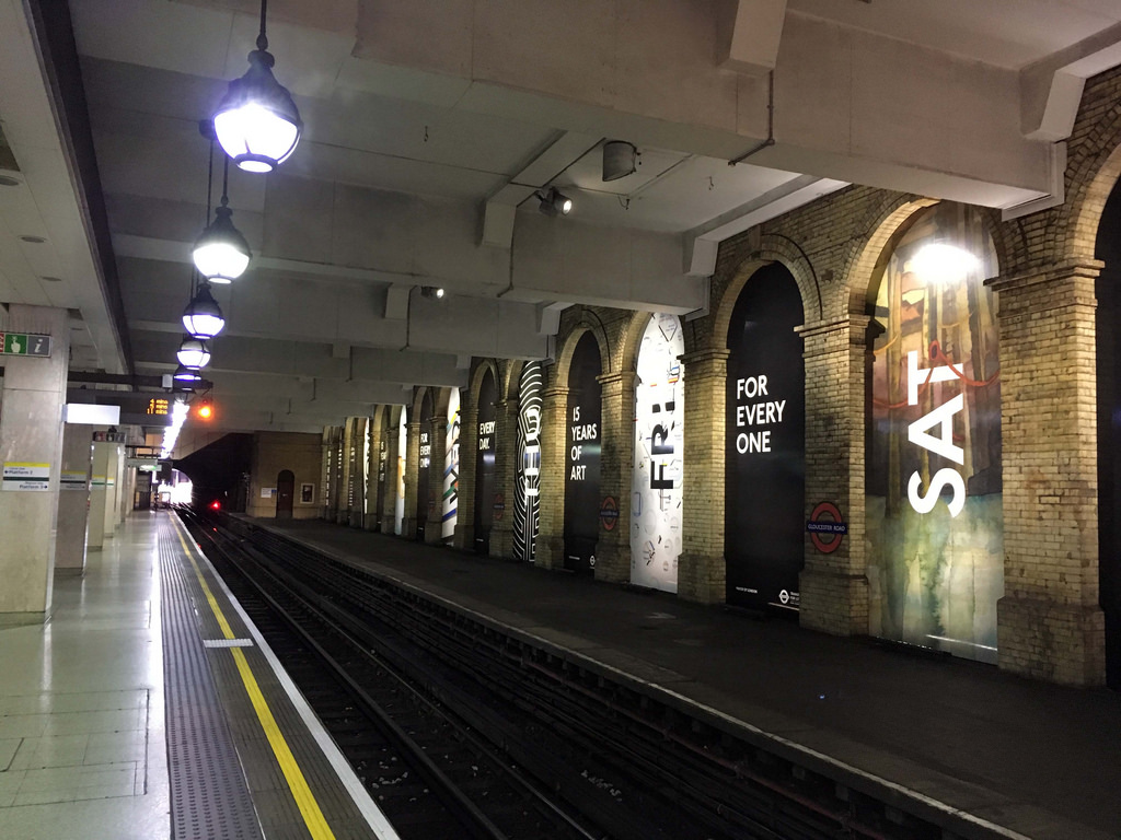
Nowadays the station is served by the Circle, District and Piccadilly Lines (no longer by the Metropolitan). The station has been much changed over the years, the sub-surface platforms were rafted over in the 1990s [3][4] to allow apartments and shops to be built on top though the station has retained a number of historic features including platform indicators. One of the four original sub-surface platforms is now disused.
The sub-surface platforms

View from the footbridge 
A District Line S7 stock train bound for Ealing Broadway

Platform indicators

An S7 stock train waits to depart

Disused platform 4

[1] Jason Cross, London Underground Guide 2017 (Train Crazy, 2017) p. 126
[2] Desmond F Croome, The Piccadilly Line (Capital Transport, 1998) p. 75
[3] Paul Moss, London Underground (Haynes, 2014) p. 160
[4] John Scott Morgan, London Underground in Colour since 1955 (Ian Allan, 2013) p. 17