Leicester (LEI)

An updated version of this station profile can now be found on our dedicated railway station website

Leicester is a major stop on the Midland Main Line as well as a hub for services throughout the East Midlands.
EMR 156 406 stands at Leicester


Information
Type: National Rail (Midland Main Line)
Station code: LEI
Opened: 1840
Platforms: 4

The station was opened by the Midland Counties Railway in 1840 (though an earlier station was built elsewhere in the city in 1832). The station was later owned by the Midland Railway, under whom the station was renamed Leicester Campbell Street.

The current main statoon building dates from a major rebuilding of the station in the 1890s when the station was renamed Leicester London Road. It was built with an overall roof over the platforms, however this badly deteriorated after being damaged in the Second World War, the remains were finally removed in the mid-1970s [1]. The station name was changed to simply Leicester in 1969 after the closure of the two other stations in the city in the late 1960s. Further changes to the station including the current booking hall and the platform facilities date from modernisation in the late 1970s.

The platforms are partially covered by modern canopies. There are overall footbridges at both ends of the platforms.

The station has four platforms and is a major stop on East Midland Railway services between London St. Pancras and the North, there are also regular services to other destinations such as Birmingham New St, Derby and Loughborough by EMR and Cross Country.
EMR 222 004 departs


View down the platform, note the canopy

An EMR train stands under the footbridge at the end of the open air end of the platforms

View of the footbridge

EMR 156 498 stands on Platform 4

[1] Vic Mitchell & Keith Smith, Coventry to Leicester (Middleton Press, 2017) Fig. 89

Kirkdale (KKD)

An updated version of this station profile can now be found on our dedicated railway station website

Kirkdale is a stop on the Northern Line of the Merseyrail network at the junction of the Ormskirk and Kirkby branches and is in between Sandhills and Walton or Rice Lane. The station is next to Kirkdale TMD which is the largest depot on the Merseyrail network.
Ormskirk bound Merseyrail 507 016 arrives at the station


Information
Type: National Rail
(Merseyrail Northern Line)
Station code: KKD
Opened: 1848
Platforms: 2

The station was opened as Bootle Lane in 1848 on a joint line built by the Liverpool, Ormskirk & Preston and Liverpool & Bury Railways. The station was renamed Kirkdale in 1877.

Although still a busy spot on the network Kirkdale used to have a number of other lines and routes pass through or underneath the station. Since 1977 it has been part of the Merseyrail network and is the interchange between the Kirkby and Ormskirk branches which diverge just North of the station.

 
The station was refurbished and modernised in 2000 with a new footbridge and an improved booking office.
Merseyrail 508 124 rests on a TMD siding next to the station


Merseyrail 507 023 departs Kirkdale

Combined footbridge and ticket office


Look down the platform, the TMD is in the background 
Departing for Liverpool

Jewellery Quarter (JEQ)

An updated version of this station profile can now be found on our dedicated railway station website

Jewellery Quarter is a stop on the Birmingham Snow Hill - Worcester Line between Snow Hill and The Hawthorns.
WMR 172 005 departs Jewellery Quarter


Information
Type: National Rail (Snow Hill Lines)
Station code: JEQ
Opened: 1995
Platforms: 2 (+ 2 Midlands Metro)

Jewellery Quarter, serves the area of the same name just outside Birmingham city centre. The station was opened in 1995 as part of the restoration of cross-city services via Birmingham Snow Hill. No station had existed at this location previously though the former station of Hockley, which closed in 1972, was located nearby [1].

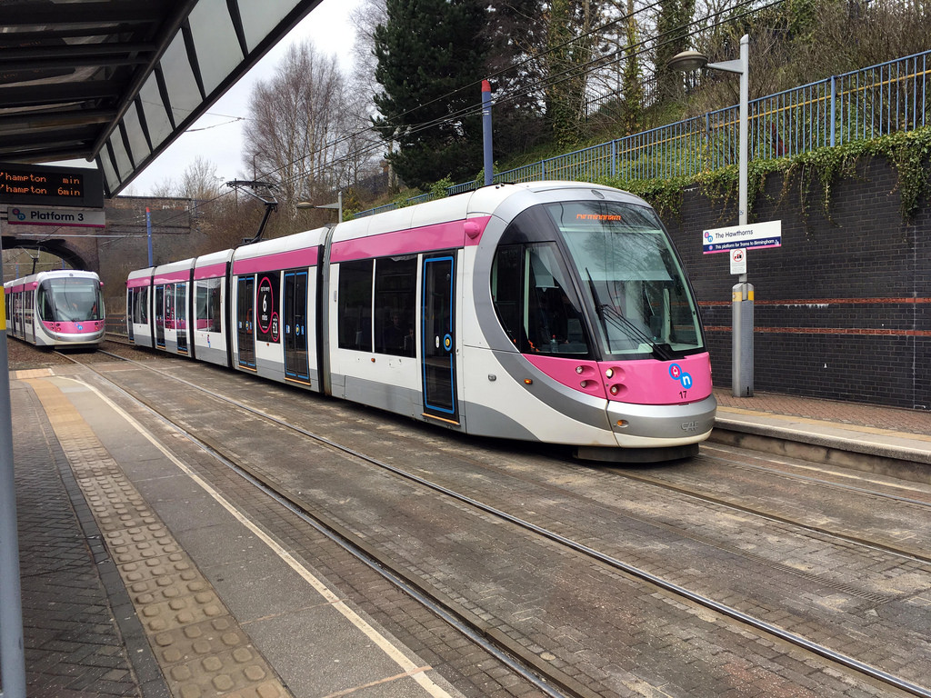
In 1999 the Midland Metro tram began operating, a stop at Jewellery Quarter is adjacent to the railway station (and with access via the platform). Access between the two railway platforms is via a footbridge.


Most services to Jewellery Quarter are operated by West Midlands Railway but some Chiltern Railways trains also stop during peak hours.
Station footbridge, a tunnel is just beyond the platforms at the Birmingham end

Chiltern 168 005 at Jewellery Quarter

Down this platform for the trams

Tram stop

In LM days 172 336 departs

Hartlebury (HBY)

An updated version of this station profile can now be found on our dedicated railway station website

Hartlebury is a stop on the Worcester-Birmingham Line in Worcestershire between Droitwich Spa and Kidderminster
WMR 172 211 departs the station


Information
Type: National Rail (Worcester-Birmingham Line)
Station code: HBY
Opened: 1852
Platforms: 2

The station was opened by the Oxford, Worcester & Wolverhampton Railway in 1852, later becoming part of the Great Western Railway. In 1862 it became the original starting point of the Severn Valley Railway through to Shrewsbury. Services to Stourport-on-Severn and Bewdley continued until 1970 and the line to Stourport remained open for freight until 1979.

The station is now unstaffed though the original station building remains, however now has a non-railway use. The footbridge (which was at the level crossing end of the station [1]) and canopies have been removed, access between the two platforms is via a level crossing at the Kidderminster end of the station. The station's facilities are the usual bus shelters and information screens found on an unstaffed station. At the other end of the platforms was a goods yard and cattle dock which were both closed in the 1960s as did another goods yard at the other end of the station,

The station is managed by West Midlands Railway though retains a GWR style nameboard as with a number of stations on the Birmingham Snow Hill lines.
Station sign next to the level crossing

Former station building, now a restaurant and bar

Bus shelter and PIS

GWR style nameboard

WMR 172 221 departs for Worcester


[1] Vic Mitchell & Keith Smith, Worcester to Birmingham (Middleton Press, 2007) Fig. 23

Marston Green (MGN)

An updated version of this station profile can now be found on our dedicated railway station website

Marston Green is a stop on the West Coast Main Line in Solihull in between Birmingham International and Lea Hall. The station is literally at the end of the runway for Birmingham Airport though Birmingham International is the station for airline passengers as this is near the terminal building.

Information
Type: National Rail
(West Coast Main Line)
Station code: MGN
Opened: 1838
Platforms: 2
The station was opened by the London & Birmingham Railway in 1838 on their line between Birmingham and Coventry. The station originally had two goods sidings and a refuge siding. The goods yard was closed in 1964. The signalbox remained in use until 1976.

Due to the proximity of Birmingham Airport (originally Elmdon Aerodrome) there were emergency signals at the station for the event of an aeroplane landing on the railway line!
Both platforms originally had wooden buildings with canopies but following electrification of the line in the 1960s and a rebuild of the station in the mid-1970s nothing of the original station now remains [1].  The station is served by West Midlands Railway and London Northwestern Railway.
TfW 158 838 passes through

Main station building

LNWR 350 107 arrives with a Birmingham bound service

View from the footbridge

View towards Birmingham

A London Euston bound Pendolino passes through

[1] Vic Mitchell & Keith Smith, Rugby to Birmingham (Middleton Press, 2008) Fig. 99

Bilbrook (BBK)

An updated version of this station profile can now be found on our dedicated railway station website

Bilbrook is a stop on the Birmingham-Shrewsbury Line in South Staffordshire between Wolverhampton and Codsall.
WMR 170 508 departs North

Information
Type: National Rail (Wolverhampton-Shrewsbury Line)
Station code: BBK
Opened: 1934
Platforms: 2

The station was opened by the Great Western Railway in 1934 in what was then the London Paddington to Birkenhead Line. The station was known as Birches & Bilbrook Halt when it opened, it reverted to the current name in 1974.

The two platforms are staggered either side of a road bridge with access to the platforms via ramps from the road. The station is unstaffed with just the basic bus shelters and information screen for passengers. The station is served by at least one train an hour by West Midlands Railway.
The two platforms are either side of this bridge

Station sign

View from the bridge

On the platform

Shelter, information screen and signage

Warwick (WRW)

An updated version of this station profile can now be found on our dedicated railway station website

Warwick is a stop on the Chiltern Main Line in Warwickshire between Warwick Parkway and Leamington Spa.
Chiltern 168 005 arrives at Warwick


Information
Type: National Rail (Chiltern Main Line)
Station code: WRW
Opened: 1852
Platforms: 2

Warwick was opened by the Great Western Railway in 1852 on it's line between Oxford and Birmingham. The station was expanded in 1890 with the platforms lengthened. Warwick once had a bay siding for a bank engine to assist heavy goods trains up Hatton bank towards Birmingham.

Warwick had two goods yards, one for the gas works and the other for the Royal Agricultural Society which held shows nearby [1]. The goods yards and bay siding have now gone following rationalisation in the mid-1960s, as have the station buildings on the Up (London) line. The station building on the Down line still survives. The station has a small cafe and waiting room. Access between the platforms is via a subway.

 
The station is managed by Chiltern Railways who supply most services to the station on the Birmingham-London Marylebone route and services to Leamington Spa either from Stratford-upon-Avon or Birmingham Moor Street. West Midlands Railway also stop at the station at peak times. 

Since the opening of Warwick Parkway in 2000 the original Warwick has become overshadowed to an extent by the new station as it has a better intercity service and much better parking.
Main station building

A Stoneblower passes through the station

Station frontage

Station sign

Two Chiltern services at the station

[1] Vic Mitchell & Keith Smith, Banbury to Birmingham (Middleton Press, 2004) Map XIV

Wigan Wallgate (WGW)

An updated version of this station profile can now be found on our dedicated railway station website

Wigan Wallgate is one of two stations in Wigan's town centre (the other being Wigan North Western which is about 100m away). Wigan Wallgate is a stop on the Manchester-Southport and Manchester-Kirkby Lines. 
Station frontage


Information
Type: National Rail (Manchester-Southport &
Manchester-Kirkby Lines)
Station code: WGW
Opened: 1848
Platforms: 3

The station was opened by the Lancashire & Yorkshire Railway in 1848 to the East of the current location. The station on the current site was opened in 1896. The station was originally known as Wigan but was renamed Wigan Wallgate in 1924. The Victorian platform level buildings were demolished in 1978 though the street-level building has survived.

The station is managed and served by Northern with up to six trains an hour departing from the station. The platforms are in a cutting with two through platforms and a bay for services towards Southport and Kirkby.

Canning Town (CNT/ZCB)

An updated version of this station profile can now be found on our dedicated railway station website

Canning Town is a major interchange of the Jubilee Line (between North Greenwich and West Ham) and two Docklands Light Railway lines (between East India and Star Lane and Royal Victoria and West Silvertown) and local buses in East London.
A Docklands Light Railway train arrives


Information
Type: Transport for London (Jubilee Line &
Docklands Light Railway)
Station code: CNT/ZCB
Opened: 1847
Platforms: 6

The station was first opened in 1847 as Barking Road by the Eastern Counties & Thames Junction Railway.

The station was renamed Canning Town in 1873 and moved in 1888, with another move to the current site (the site of the former Thames Iron Works [1]) in 1995 as part of the new Docklands Light Railway (DLR) line to Beckton. The biggest change came with the arrival of the Jubilee Line in 1999, the Jubilee Line Extension emerges into the daylight just before the station. In 2005 more platforms for the DLR's line to London City Airport were added.

Canning Town is a triple decker building with the booking hall below ground and the Jubilee Line platforms above it, the Beckton DLR platforms are on the top level [2][3]. The latest DLR platforms are on ground level next to the Jubilee Line - though passengers need to go down to the booking hall before they can come back up for interchange.
Jubilee Line 96024 prepares to depart

The Jubilee Line platform

The lower level DLR platforms

View down the Jubilee Line platform

Jubilee Line 96015 arrives


[1] Jason Cross, London Underground Guide 2017 (Train Crazy, 2017) p. 108
[2] Paul Moss, London Underground (Haynes, 2014) p. 166
[3] Mike Horne, The Jubilee Line (Capital Transport, 2000) p. 73

Manchester Oxford Road (MCO)

An updated version of this station profile can now be found on our dedicated railway station website

Manchester Oxford Road, the second busiest station in central Manchester, serves lines going East-West across the city.

Information
Type: National Rail
Station code: MCO
Opened: 1849
Platforms: 5
The station was opened in 1849 by the Manchester, South Junction and Altrincham Railway (MSJAR) as Oxford Road. Originally the station was a small affair with a couple of platforms for services from the East including Manchester Piccadilly (then London Road). The station slowly expanded over the years with extra platforms and services added including West to Liverpool.

The station was rebuilt in 1903-4, with the platform layout redesigned. A further rebuilt took place in 1960 with the new station buildings with a roof that consisting of three overlapping cones, innovative architecture which found favour with a number of critics even Nikolaus Pevsner. The architect Max Clendinning intended the station to be imagined as a giant piece of furniture! [1]

Unfortunately the roof, which was mostly made from timber [2], has proven rather prone to leaking and has required regular attention. Further improvements of the station have taken place in the 1990s and 2010s as it has become steadily busier. It is proposed to lengthen the station platforms as part of the Northern Hub project though this would require the knocking down of a number of adjacent properties, the station being in an awkward trapezium shaped site.

The station is served by Northern, Trans Pennine Express, Transport for Wales and East Midlands Trains.
TPE 185 444 departs

View down the platform

Station sign

Notice the canopies

Station frontage

A TPE train prepares to depart

[1] David Lawrence, British Rail Designed 1948-97 (Ian Allan, 2016) p. 78
[2] Bruce Peter, The Changing Face of British Railways (Lily Publications, 2018) p. 139